
Page 49 - GCN, March/April 2016
P. 49
case study OPEN DATA
LA GeoHub: A model for
‘datafying’ communities
A Los Angeles portal goes beyond offering location-based data
by allowing city employees and the public to build and share apps
BY PATRICK MARSHALL
Los Angeles isn’t the first Amer- ican city to open selected da- tabases to the public. How- ever, the launch of GeoHub in January might be the most ambitious effort to date.
As what the city calls “one of the nation’s most complete collections of urban map data,” GeoHub is a portal of location-based open data from city departments that empowers employ- ees and the public to explore, analyze and build on the data.
“On its own, data gives us impor- tant insights into how our city works, and now we are putting open data to work,” Mayor Eric Garcetti told the press in January. “The GeoHub pro- vides real-time access to all the data we need in one convenient place, al- lowing us to improve everything from pothole repair to 311 call times, make smarter urban planning decisions and make it easier for emergency respond- ers to get to their next location.”
Three things make GeoHub special. First, the data offered via the portal is very broad — more than 500 datasets from more than 20 city and county agencies, including real-time traffic data, road obstructions, the inspec- tion status of nearby buildings, busi- ness activity and even the nearest fire hydrants.
Second, recognizing that much community data is inherently geo- graphical, the city designed the portal
from the ground up in partnership with Esri, the geographic information systems company.
Third, the aim of GeoHub isn’t just to offer data, it is to infuse the commu- nity with data and applications gener- ated by the city and others. In short, the goal is to “datify” the community.
The portal offers application pro-
gramming interfaces and software development kits, as well as map templates, configurable apps and app builders to quickly develop, customize and deploy projects. Brian Cross, di- rector of professional services at Esri, said an app development challenge is planned for the first quarter of this year.
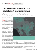
The city of Los Angeles’ GeoHub portal provides more than 500 datasets that can be visualized — such as the Road to 2400 (seen above), the initiative to repave 2,400 miles of streets.
GCN MARCH/APRIL 2016 • GCN.COM 47
LAHUB.MAPS.ARCGIS.COM
